Tiếng Việt
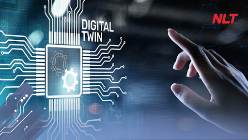
In the era of digitalization and smart city development, managing a city with millions of residents alongside a complex technical infrastructure system faces unprecedented challenges. To solve this problem, Urban Digital Twin technology emerges as a core key, opening a comprehensive revolution in monitoring, forecasting, and optimizing living spaces. The article below will decode this groundbreaking solution in detail and show how this technology shapes the appearance of modern future cities.
What is an urban digital twin?
The concept of urban digital twin
An Urban Digital Twin is a 3D model on a computer, simulating the entire real-life city in the most accurate way. It is like a mirror reflecting everything from the real world into digital space, from buildings, roads, electricity and water systems to the surrounding traffic situation and environment.
What makes the core value of this technology is the ability to truly reflect the operating state of the city, helping humans observe and manage a miniature urban area right on the control screen.
How is an urban digital twin different from a regular digital map?
The comparison table below will help you clearly distinguish these two concepts through their core characteristics.
| Characteristics | Urban Digital Twin | Regular digital map |
Data | Dynamic data Updated by every second, every minute | Static data Fixed at a single point in time |
Interaction | Two-way interaction Continuously connected with the field | One-way interaction Only view available information |
| Nature | Like a living entity changing in real-time | Like a fixed snapshot photo |
The foundational technologies helping an rrban digital twin operate effectively
- IoT system: Collects real-time data on traffic, weather, and energy to transmit to the center.
- GIS and BIM systems: Create a digital skeleton framework helping accurately and detailedly digitalize the entire three-dimensional space of the urban area.
- Artificial Intelligence (AI): Acts as the brain analyzing huge volumes of data to provide accurate trend forecasts and risk identification.
Why does the urban digital twin become a trend in city management?
Urban areas are increasingly complex and difficult to control by manual methods
Population growth accompanied by dizzying urbanization speed is creating huge pressures on urban infrastructure. Traffic congestion, environmental pollution, flooding, and infrastructure overload issues are becoming increasingly painful. Authorities cannot continue to coordinate and control quality using only stacks of paper documents or manual patrols. And as urban problems get more complex day by day, relying only on regular human resources will no longer be enough to maintain the stability of the entire system.
The demand for real-time infrastructure monitoring is higher and higher
In a fast-moving society, delays in capturing information will lead to severe consequences. Managers cannot wait until a route is frozen in traffic jam for hours or a transformer station catches fire and shorts out before starting to send personnel to find out the cause. The urgent requirement now is that they must see the operating state of each light bulb and each drainage manhole right at the current moment to immediately offer appropriate coordination plans.
Data becomes the foundation for smart cities
The 21st century witnesses the rise of data, and this is considered an invaluable asset of every nation. The Urban Digital Twin is the solid anchor helping gather, classify, and clean all data sources currently scattered everywhere. Through the processing process, dry numbers will be transformed into highly oriented information, effectively serving the planning and sustainable development strategies of local governments.
How does an urban digital twin change the way a city operates?
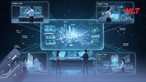
The urban digital twin helps digitalize all infrastructure on a single platform
The Urban Digital Twin has thoroughly solved the problem of data isolation among departments by gathering scattered infrastructure information onto a single digital platform.
This unification helps smash information barriers and cumbersome procedures, allowing managers to easily access and cover the comprehensive overall picture of the city and coordinate inter-disciplinary work processing quickly.
Monitor operating status in real-time
The system automatically collects and reports all dynamic data from the field to the operation center through the Urban Digital Twin technology. Thanks to the visual information display capability in real-time, managers no longer have to wait for cumbersome manual reports, thereby always proactively grasping the actual situation closely to promptly provide effective resource coordination plans.
Early detection of incidents and potential risks
Thanks to integrating machine learning algorithms analyzing complex behaviors, the Urban Digital Twin can automatically calculate and provide early warnings about risks such as system short-circuit fires, infrastructure incidents, or traffic jams. These forecasting reports help governments proactively grasp the situation to promptly handle and prevent risks right before they can actually happen.
Optimize the economic problem thanks to cutting down operating costs to the maximum
The Urban Digital Twin technology helps optimize the economic problem through allowing engineers to simulate and test operational scenarios on virtual environments before real application to avoid costly errors.
The system will automatically calculate the most optimal operating plan, while remote monitoring helps reduce the frequency of field patrols, cutting down labor and infrastructure maintenance costs to the maximum.
Support managers to make fast decisions with data
Thanks to deep and visual analysis reports from verified real-time data sources, the Urban Digital Twin helps completely eliminate making decisions based on personal emotions. This scientific database source brings great confidence to leaders when approving or adjusting large planning projects, ensuring the highest feasibility and optimizing resources for the community.
The urban digital twin promotes proactive management instead of reactive operation
Instead of the traditional coping path when having to wait for incidents to occur and receive feedback before sending forces to fix them, the Urban Digital Twin technology completely changes this mindset by providing accurate forecasting capability for fluctuating trends.
The strong shift from a passive coping stance to a proactive control and early risk prevention stance is the core key to creating a peaceful, stable living space for residents.
Fields that can apply the Urban Digital Twin
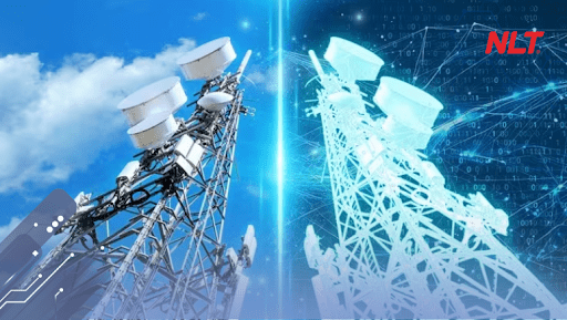
Apply the urban digital twin in smart traffic management
- Flow monitoring: The system automatically collects and visually reports vehicle density in real-time, helping the management board easily monitor the field comprehensively without wasting patrol effort.
- Signal regulation: From accurate analysis figures, operators can proactively reconfigure signal light timing from afar to instantly clear intersections at risk of congestion.
- Remote lane splitting: Functional forces promptly grasp the situation to provide alternative movement route guidance for citizens, helping proactively reduce traffic pressure during peak hours.
Manage urban lighting systems
- Power optimization: The system automatically collects and statistically details power consumption in each area, supporting managers to set up smart dimming scenarios during late-night hours, helping save operating costs significantly.
- Flexible by demand: Allows customizing the setup of diverse lighting scenarios according to the investor’s separate requirements such as increasing brightness during festivals, reducing light in low-peak areas, or turning on/off seasonally.
- Timely maintenance: The system automatically monitors the operating state of each device, immediately detects incidents, and accurately displays locations on digital maps, helping the technical team approach and handle right away instead of waiting for feedback from residents.
Manage greenery, landscape, and environment
- Greenery monitoring: Digitalize and store all data on GPS coordinates, height, and growth process of each shade tree, helping the management board easily check the health status of the urban greenery system on digital platforms.
- Natural disaster response: Automatically analyze and filter out old trees or tilted trees so that managers can proactively plan to prune branches, lower height, or reinforce timely before the rainy and stormy season of falling down occurs.
- Air quality tracking: Integrate data from monitoring stations to continuously update pollution indexes in real-time, helping authorities promptly give health protection warnings.
Manage waterway traffic
- Ensure safety: The integrated system helps continuously update coordinates and the status of the buoy network and channeling signs, promptly detecting drifting buoy incidents to ensure boats travel on the correct safe route.
- Density control: Use smart cameras to continuously monitor the flow and speed of boats on crowded channeling routes, helping coordinate trade smoothly from afar and preventing collision risks to the maximum.
Manage water supply, drainage, and flooding prevention
- Water level warning: Technology automatically calculates rainfall and measures water levels at canals and rivers in real-time, providing early flood forecasting scenarios for engineers to promptly grasp the situation.
- Proactive response: Based on visual forecasting data, the operation team can proactively regulate flow volume from afar, helping clear water pressure quickly and keeping streets dry.
Manage technical infrastructure and urban assets
- Archive files: Synchronize and archive all 3D design files, technical drawings, and detailed history of projects like overpasses, underpasses, and highways on a single system, helping look up information quickly when needed.
- Detect degradation: Integrate sensor data to inspect and evaluate the actual bearing capacity and stress of projects, helping detect early internal cracks or empty subsidence spots inside structures before surface deformation.
- Extend project lifespan: Provide a comprehensive picture of the infrastructure status, acting as a scientific basis for the management board to proactively plan periodic restoration and maintenance, helping optimize costs and extend project exploitation time to the maximum.
Benefits of the urban digital twin for managers
Have a comprehensive look at the entire city
The capacity to cover problems is always the vital factor of an excellent leader. This solution completely eliminates blind spots in traditional management work by gathering all urban data layers into an extremely sharp panoramic picture.
Only with simple operations on the centralized monitoring screen, managers no longer have to wait for reports from departments and agencies but can capture immediately:
- The fluctuation of socio-economic flows through visual display indicators.
- The actual operating state of all facilities, traffic networks, and technical infrastructure in the territory they are in charge of.
- The interaction and cross-impacting relationship among different infrastructure components in the urban area.
Increase transparency in monitoring and operation
When the entire operating process is digitalized, transparency will be pushed to the highest level. Actual data collected from sensors is objectively stored on cloud computing platforms.
This automation process completely eliminates the risk of being interfered with, modified, or distorted in data due to human subjective factors. The clarity of real-time data is the solid foundation to consolidate trust between state management agencies and infrastructure construction contracting units, while creating great consensus towards the resident community living in the area.
Shorten the time to detect and handle incidents
Reaction speed decides the consequence of an urban incident. Instead of losing hours to manually screen suspected areas, instantaneous positioning and warning technology helps rapid response teams like fire fighting, electrical engineering, or medical rescue approach the exact target location within just a few short minutes. This agility not only protects assets but can also save many lives in emergency situations.
Optimize operating and infrastructure maintenance costs thanks to the Urban Digital Twin system
Public budget sources are always limited and need to be spent in the most worthy way. By applying smart predictive maintenance processes based on analysis data, the city does not have to repair devices rampantly causing waste. Replacing and maintaining at the right time and right place will help extend the lifespan of public assets to the maximum, turning maintenance costs into a sustainable profitable investment for the future.
Improve the quality of life for residents
- Regarding living experience: Roads have less traffic jams and the air is cleaner thanks to emission sources being closely monitored.
- Regarding social security: Residents benefit directly when public services always operate smoothly.
- Regarding long-term value: The city creates a solid premise to attract and retain elite citizens to commit long-term.
Challenges when deploying the Urban Digital Twin
Urban data is still scattered in many systems
The biggest barrier in the digital transformation work is the scattering of information. For decades, departments and agencies often built separate software and data storage systems without sharing with each other. Having to gather these closed information data systems and merge them into a common database requires a very large effort in changing working mindsets and inter-disciplinary coordination.
IoT infrastructure and sensors need to be invested synchronously
For the digital twin to be able to perceive the real world, the city must be equipped with a huge sensor nervous system spreading everywhere. Purchasing, installing, and maintaining activities for thousands of smart cameras, environmental meters, or IoT connection devices require a not small initial investment capital source. The problem of searching for financial resources and calling for infrastructure socialization is always a big pressure for policymakers.
Need data standardization to ensure connection capability
Each type of hardware device or software developed by different suppliers often uses a separate data format. Without a common set of standards, these devices will not be able to communicate and transmit information to each other. Building and issuing legal regulations on computer language standardization is a complex process, requiring careful consultation from leading technology experts.
Need a deployment unit with overall technological capacity
A project bearing national stature like the Urban Digital Twin cannot be entrusted to technology suppliers lacking practical combat experience. The city needs to search for strategic partners with enough financial potential who master technology in both hardware and software aspects. Only technology corporations having overall deployment capacity are strong enough to design, operate, and maintain a highly complex system in many decades to come.
NLT Group accompanies the government in building the urban digital twin
Connect urban data on a centralized management platform
With the aspiration to create sustainable digital infrastructure for the nation, NLT Group proudly brings the Urban Digital Twin, a powerful GIS Cloud computing platform designed specifically for urban governance work. This platform possesses the capacity to receive, analyze, and smoothly process millions of complex data streams from many different sources. The birth of the system has completely solved the problem of scattered information, creating a consistent and smooth digital command center for government agencies.
Apply IoT, 3D models, and real-time data
Not just stopping at software, NLT Group completely masters the hardware supply chain by researching and manufacturing a full package of smart terminal devices such as IoT sensors, AI cameras, and specialized control cabinets. When combining with deep 3D modeling technology, we are confident to recreate a vivid digital twin, updating fluctuations in real-time and simulating accurately down to each smallest detail of city infrastructure.
Support managers to operate smart urban areas more transparently and proactively
The companionship of NLT Group does not just lie in technology transfer but is also a commitment to stand shoulder to shoulder with state management agencies in the long term. Our Urban Digital Twin system solution is creating powerful breakthroughs in the infrastructure digital transformation work, helping localities effectively manage resources and improve competitiveness. These are the most solid steps on the journey to build smart cities that develop sustainably, prosperously, and reach out to the world.
The Urban Digital Twin is the core key helping optimize infrastructure management and improve the quality of life for residents. This groundbreaking technology helps shift the city operating method towards a more proactive, transparent, and sustainable direction. NLT Group is proud to accompany the government in realizing future smart urban areas.
Nam Long Technology Investment Group (NLT Group)
- Hotline: 0911 379 581
- Email: kinhdoanh@nlt-group.com
- Tax code: 0313339640
- Address: 43R Ho Van Hue, Ward Duc Nhuan, Ho Chi Minh City