Tiếng Việt
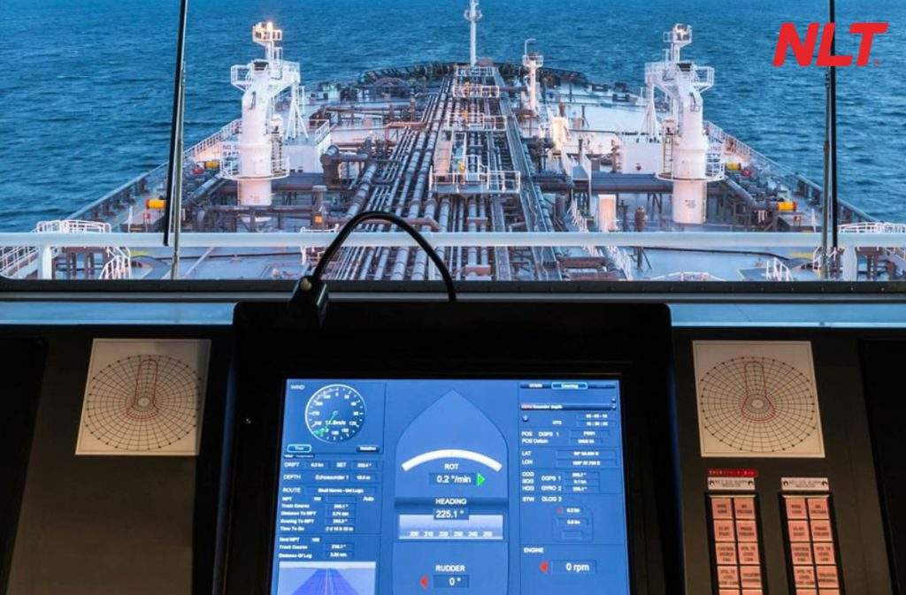
AIS maritime aid to navigation (Automatic Identification System) is an indispensable system in the maritime industry. In this article, join NLT Group to learn in detail about AIS maritime aid to navigation, how it works, and why it is so important.
What is AIS maritime aid to navigation?
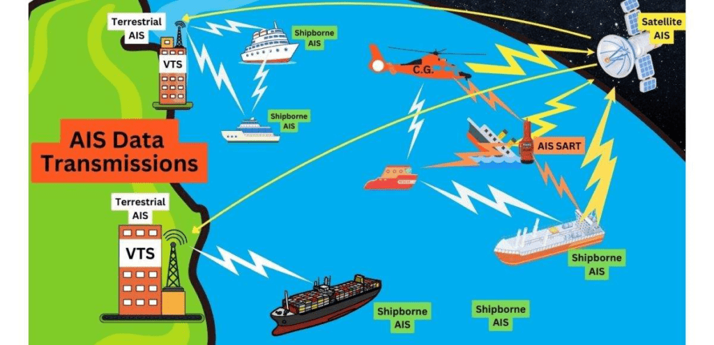
AIS maritime aid to navigation (Automatic Identification System) is an important communication system in the maritime sector, designed to enhance safety and efficiency of marine traffic. AIS aids allow vessels and shore stations to automatically transmit and receive information about position, speed, course, and other essential data.
The AIS system operates on the maritime VHF band, enabling vessels and coastal stations to identify and track each other within VHF coverage. AIS aids not only help ship captains and port operators manage traffic flow more effectively but also play a crucial role in accident prevention and supporting maritime search and rescue operations. >> See more: What is a smart inland waterway buoy?
Functions of the AIS aid to navigation system
In ensuring maritime safety, AIS aids are commonly used with the following four main functions:
- Marking navigation channels, water areas, and traffic separation schemes.
- Indicating the presence of offshore structures.
- Providing identification information of an existing maritime aid to navigation and data on meteorological and hydrological conditions at the installation area.
- Transmitting monitoring information on the position of floating aids.
Classification and installation positions of AIS waterway aids
AIS aids are classified into the following three types:
- “Real” AIS aid: installed on an existing maritime aid to navigation to transmit information about that aid.
- “Synthetic” AIS aid: installed at a location separate from an existing maritime aid to navigation to transmit information about that aid.
- “Virtual” AIS aid: installed at a certain location to transmit information about a maritime aid to navigation at a specific position where no physical aid is installed.
Operating principle of AIS aids to navigation
AIS maritime aids operate continuously 24/7, transmitting data simultaneously on two VHF channels: 161.975 MHz (87B) and 162.025 MHz (88B). During operation, AIS aids continuously and automatically broadcast pre formatted messages. The transmission interval between messages is adjusted based on maritime traffic conditions in the area or according to the requirements of the management authority. >> See more: Latest regulations on inland waterway aids to navigation
Broadcast information of the AIS maritime aid system
The formatted broadcast content used for the AIS aid system includes the following four types of messages:
Message 21: Used to transmit information about maritime aids to vessels within the effective range of the aid. The main contents of this message include:
- Type of maritime aid to navigation
- Name of the maritime aid to navigation
- Position of the maritime aid to navigation
- Position accuracy of the maritime aid to navigation
- Dimensions of the maritime aid to navigation and related reference positions
- Other management information such as the technical status of the maritime aid to navigation
Message 12: Reserved for competent authorities managing aids to navigation to transmit maritime safety information to vessels within the effective range of the aid.
Message 8: Used to transmit meteorological and hydrological information in the area where the maritime aid to navigation is installed to vessels within its effective range.
Message 6: Used to transmit operational status information of the maritime aid to navigation for monitoring and supervision purposes.
Conclusion
With its capability to automatically transmit information about vessel position and course, AIS aids not only help ship captains and management authorities easily coordinate and monitor maritime traffic but also prevent accidents and support search and rescue activities. Through this article, NLT Group hopes readers gain a clearer understanding of what AIS maritime aid to navigation is, as well as its functions and operating principles.
Nam Long Technology Investment Group (NLT Group)
- Hotline: 0911 379 581
- Email: kinhdoanh@nlt-group.com
- TIN: 0313339640
- Address: 43T Ho Van Hue Street, Duc Nhuan Ward, Ho Chi Minh City
>> You may be interested in:
Inland waterway buoy system
NLT Group – Reputable provider and installer of inland waterway buoys 2024
Digital technology based waterway traffic separation buoy system by NLT Group